033 C4ISR Stories: Computers - Data-Driven Decisions for Disaster Defence
In this episode of C4ISR Stories, titled Data-Driven Decisions for Disaster Defence, we explore the transformative role of technology in crisis management through the gripping tale of a flooded town and an improvised coordination cell. Join us as we follow Karin, an IT consultant, who turns chaos into clarity using a laptop and innovative tools to drive effective rescue efforts. Discover how computers, GIS mapping, and live telemetry reshaped decision-making, empowering volunteers to act decisively amidst the flood. This episode highlights the synergy between human ingenuity and technology in disaster response, illustrating how shared understanding can save lives. Tune in for a compelling narrative about navigating the storm with data and determination.
Full transcript
Welcome to Quebec Zulu Juliett and the third episode in our mini-series exploring C4ISR: command, control, communications, computers, intelligence, surveillance, and reconnaissance. Today’s story has the title Data-Driven Decisions for Disaster Defence and reveals the pivotal power of technology and innovative thinking amidst the chaos of disaster response. In the face of crisis, the spark of human ingenuity lights the way forward — turning despair into hope, and decision into action.
Data-Driven Decisions for Disaster Defence
I’m trying something new for this episode by integrating synthetic voices for the dialogue. If it doesn’t resonate, I’ll skip it next time or return to my original readings. I hope it enhances the storytelling experience.
Without further ado, let’s dive in…
When the river burst its banks after three days of unrelenting rain, the valley town became an island. Roads vanished under brown water, power cut out block by block, and the small volunteer fire station turned into a coordination cell for everything: evacuation, supplies, and information.
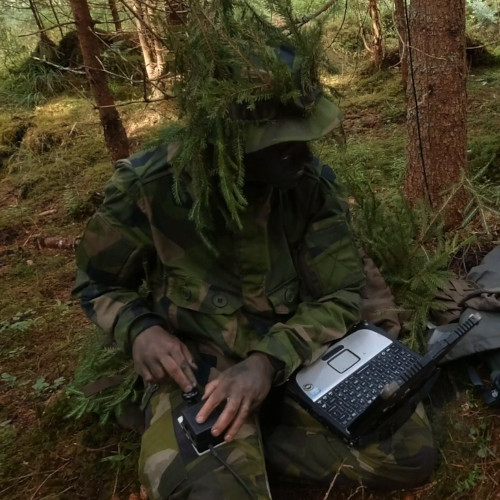
Karin was not a firefighter. She was an IT consultant who had shown up with a laptop, a spare battery pack, and an instinct to bring order to noise. Computers were not about gadgets to her; they were tools to shrink chaos into patterns.
1 — First Light in the Station
The fire station smelled of damp wool, diesel, and coffee grounds. Folding tables had been dragged together under fluorescent lights, now powered by a sputtering generator. Paper maps overlapped like shingles. Radios hissed with half-finished messages. Volunteers scribbled notes on sticky pads that curled in the humidity. Every question seemed to chase another question:
- “Do we have boats for the eastern farms?”
- “Is the bridge on South Road passable?”
- “How many people are still trapped in the care home?”
Karin set her laptop on the only dry corner of a table. She connected it to her battery pack and powered on. The familiar hum filled the space, and she allowed herself a smile. “Okay, let’s turn this chaos into a picture we can actually use.”, she said, almost to herself.
She opened a blank spreadsheet — rows and columns, stark and unambiguous.
“Let’s list every location we’re worried about,” she told the nearest volunteer. “One per row. Columns for status, needs, contacts, and time of last update.”
At first the others looked skeptical, but when she projected it against a white wall with a pocket projector, heads turned. Karin grinned and tapped the screen. “See? Not just my laptop anymore. This is our wall of truth.”
2 — From Notes to Data
At 09:30 a police officer reported: “Farmhouses east of the railway are cut off, five confirmed stranded.” Normally such a detail would vanish into someone’s notebook, hard to retrieve when needed. Instead, Karin typed it in:
Row: East Railway Farmhouses → Status: Stranded → Count: 5. The cell turned red. Everyone could see it.
“There. That’s not going to get lost on the corner of a notepad, It’s in the system now.”
At 09:42, the VHF radio crackled: “Station, this is Inflatable boat Team Two en route to care home, ETA twenty minutes. Out.”
Karin highlighted the care home row yellow. The projected sheet shifted, and she clapped her hands once. “Yes! Now everyone sees the same thing.”
For the first time that morning, a sense of rhythm emerged. People stopped asking the same question twice. Karin could almost feel the room breathing easier.
3 — Maps with Memory
A local surveyor arrived with a USB stick of terrain files. Karin opened a GIS — Geographic Information System software. Unlike a simple picture, GIS could layer data: terrain, roads, hydrology, hazards. She loaded the files and overlaid flood extent polygons, showing where water had already swallowed valleys.
Blue shapes spread across the map, turning familiar roads into drowned lines. Someone cursed softly under their breath. Karin pointed at the wall. “It looks terrifying, but this is power. Now we know. And if we know, we can act.”
When a volunteer asked, “Can we reach the farmhouses from the west?” Karin toggled layers and answered, “Negative. Road submerged. Best approach is from the north via the gravel track.”
It wasn’t guesswork. It was clarity backed by data. And Karin couldn’t resist adding, “See? The computer isn’t just a curiosity — it’s an essential tool.”
4 — Order from Noise
By noon, the hall pulsed with activity. Reports poured in: some from radios, others from people running through the door dripping wet. Each entered the spreadsheet, tagged with a time. The GIS map grew denser with colored polygons. Where there had been uncertainty, there was now a surface everyone could see.
Karin noticed a pattern: reports of stranded families clustered along tributaries where floodwaters rose fastest. She shaded those valleys orange. When a volunteer asked if they should send a team now or wait, Karin pointed. “This area will be cut off within two hours. Send them now. Please — don’t wait until it’s too late.”
The volunteer nodded and dashed off. Karin exhaled and whispered, “Good. That’s one less red box later.”
5 — Ham Radio Joins In
Mid-afternoon, the local ham radio club arrived carrying a plastic crate of handheld VHF radios with built-in GPS receivers. Each was configured with APRS — Automatic Packet Reporting System. APRS allowed radios to broadcast position and short data packets. A Raspberry Pi with an SDR receiver sat in the crate, decoding packets and logging them into a database.
Karin’s eyes lit up. “You just brought us live telemetry!” she said, almost bouncing on her heels. She distributed the handhelds to rescue teams. “Keep these powered. We’ll see you move on the map.”
She spent a couple of hours coding a backend application to poll the database and push live updates into the GIS software. As the first dots appeared, crawling along blue channels and inching down gravel roads, Karin let out a laugh. “Look at that! You’re moving dots now. You’re visible.”
The room cheered quietly. The map was no longer static. It was alive.
6 — A Living Map
Volunteers no longer shouted across the room to ask where teams were. They pointed at the wall. “Team Two is here… twenty minutes out.”
The fire chief leaned on the table, watching dots move. “Feels like a command center,” he murmured.
Karin grinned, brushing hair back from her damp forehead. “Feels like control to me… And that’s better than panic.”
Sensor fusion made it stronger: APRS positions overlaid with flood polygons, rainfall charts predicting where water would climb, and manual notes tied to icons. What had begun as a spreadsheet now resembled the command post of a national operation, run on laptops and goodwill.
7 — Forecasting Trouble
At 16:00 the university engineering club arrived with boxes of improvised devices. They had been experimenting with LoRa radios — low-power, long-range transceivers operating slightly below the L-band, perfect for sensors. With quick adjustments, they turned the devices into water-level monitors and weather nodes.
The students waded into the edges of the flood and deployed them along bridges and riverbanks. Each LoRa beacon reported back to a central gateway, which fed the database on the Raspberry Pi. Within an hour, Karin’s GIS screen blinked with new icons — green dots pulsing live water-level readings.
One sensor spiked faster than expected. Karin squinted at the graph, cross-checked with rainfall data, and slapped her palm on the table. “This tributary will breach the ridge in two hours! That hamlet is about to be cut off. Redirect boats now!”
The chief relayed the order. Radios came alive. When the water finally did rise, the hamlet was already empty. Karin leaned back, relief washing over her. “That’s the kind of win we need,” she said, her voice cracking slightly from exhaustion.
8 — When the Helicopter Asked
A helicopter pilot’s voice crackled: “Station, this is Chopper. Approaching from the east. Request landing zone. Over.”
Karin zoomed out, measured an open football field on the GIS map, dropped coordinates, and relayed them. Minutes later, rotors thundered overhead, and pallets of supplies landed on dry ground. Karin grinned as volunteers rushed to unload. “See? Computers can make blankets fly!”
The fire chief chimed in, crossing his arms. “Sure, but last I checked, they’re not magic carpets. If only they could make the flood disappear as easily!”
Karin chuckled, “Well, if I could program that, I’d fly that carpet to work every day!”
9 — Evening in the Station
By nightfall the flood was not gone, but the station had transformed. Radios hummed steadily, dots moved, polygons updated, and the spreadsheet glowed. Volunteers who had been frantic in the morning were now purposeful.
Karin sat back, exhausted, hair plastered to her forehead. She rubbed her eyes and looked at the wall where the map pulsed with data. “It’s not perfect, but it’s the best picture we’ve ever had.”, she murmured, half to herself.
Someone brought her a cup of lukewarm coffee. She raised it in a small toast to the screen. “To clarity,” she whispered, and drank.
10 — The Larger Picture
The coordination cell had become an impromptu C4ISR node without anyone calling it that. Command and control emerged as the fire chief set intent and volunteers adjusted details. Communications flowed through VHF radios, ham repeaters, and shouted updates. Computers — Karin’s domain — turned all of it into shared understanding. Intelligence and surveillance threads were already forming: other volunteers were preparing to head out into the countryside to confirm road conditions, while the engineering students’ static sensors would keep watch through the night.
That’s the end of this story about the fourth C in C4, Computers. Now to the After Action Review…
After Action Review (AAR)
1) What was supposed to happen?
Ad hoc volunteers needed to coordinate rescue and relief in a flooded town with no central system.
2) What actually happened?
Initial chaos was tamed by a laptop-based spreadsheet, then amplified by GIS mapping. With APRS radios feeding live team positions into the system, Karin built a real-time operational picture. Later, LoRa water-level sensors and weather stations expanded the picture further. Rescue became proactive, not reactive.
3) Why did it happen?
- Computers extended memory and visualization under stress.
- A projected display created a common operational picture.
- GIS layered terrain, flood, and team data into a shared map.
- APRS plus database integration created a living view of team positions.
- LoRa sensors provided continuous telemetry, feeding forecasts and alerts.
- Forecasting from sensors allowed anticipation rather than reaction.
- Karin’s enthusiasm and clarity rallied volunteers to trust the system.
4) What did we learn?
- Computers in C4ISR are decision-support tools, not magic — they give structure to chaos.
- Energy, positivity, and communication matter as much as the technology itself.
- Simple systems can scale when paired with discipline and visibility.
- Radio and computing fused into situational awareness stronger than either alone.
- LoRa and APRS proved that improvised civilian tech can become powerful ISR inputs.
- A common operational picture is the foundation for coordination.
- In disaster or war, the power of computers lies not in silicon, but in the human capacity to use them for shared understanding.
Computers didn’t save anyone—people did. But the shared picture they created helped everyone move faster and safer. If you run a team, ask: what’s our ‘wall of truth’?
The next episode is about Intelligence—the ground truth that feeds the map. To get in touch with the podcast, visit qzj.se, I spell, quebec zulu juliett dot sierra echo, qzj.se and there you’ll find contact information. Thank you for listening. Until next time: Stay safe, stay prepared, and stay curious. This is Mike, Out.